Iceland is a wonderful country for wildlife spotting. As we saw many species in different location I decided to put them all together in one post.


Iceland is a wonderful country for wildlife spotting. As we saw many species in different location I decided to put them all together in one post.
After three days on the south coast of Iceland it was time to move on to Reykjavik, the islands capital city. 120,000 people live here, about 37% of the total population of Iceland. At a latitude of 64°08′ N, this makes it the world’s northernmost capital city.

We stayed at Rey Appartments just around the corner from Laugavegur the main street for shopping, bars and restaurants. Our first job was to find a launderette as our two previous stops did not have any laundry facilities. A short walk brought us to The Laundromat Cafe, a launderette downstairs and a bar/cafe upstairs. A beer whilst your laundry is doing seems very civilised.
Over the next three days we toured the city and had a day out around “The Golden Circle” a popular route in South Iceland, covering about 300 km looping from Reykjavík into central Iceland and back. The three primary stops on the route are the national park Þingvellir, the geothermally active valley of Haukadalur, which contains the geysers Geysir and Strokkur, and the waterfall Gullfoss (meaning “golden falls”)
Our first stop was Þingvellir where the Alþingi (Althing in English), the Icelandic Parliament, was established in 930, and remained there until 1798. It is the oldest extant parliamentary institution in the world.


Next stop on the Golden Circle is Haukadalur where the geyser that all others were named after is located. Unfortunately Geysir has been inactive for quite some time although there are other geysers in the area. However its pretty tame compared to Yellowstone in the USA.


Next stop the magnificent Gullfoss waterfall, gullfoss means golden waterfall. The water coming down the river Hivita flows down into a wide curved three-step “staircase” and then abruptly plunges in two stages (11 m and 21 m) into a crevice 32 m (105 ft) deep. This is a very busy tourist destination with a large visitor centre and restaurant. The speciality is lamb soup, more like a stew such as the Welsh dish cawl, with free refills! Insider tip, have lunch before midday otherwise its compete bedlam.


Our next stop was Hveragerði, which somewhat grandly proclaims itself “The hot springs capital of the world”. What they do have is a small geothermic park where you can boil an egg in a stream and a cafe famous for its geothermal ovens.


And so back to Reykjavik. A couple of days exploring the sites, checking out the craft beer bars, sampling the restaurants and my birthday celebration thrown in for good measure.So what better place to start than church, as we were staying round the corner from Hallgrímskirkja, Iceland’s magnificent modern cathedral. State Architect Guðjón Samúelsson’s design of the church was commissioned in 1937. He is said to have designed it to resemble the basalt lava flows of Iceland’s landscape. It took 38 years to build the church. Construction work began in 1945 and ended in 1986.


After a church a wander round the city.


For most of the 20th century beer was either banned or limited to 2.25% ABV. Indeed this limit still applies in supermarkets. The restrictions were lifted on March 1st, 1989. The lifting of restrictions on beer is celebrated as Beer Day on March 1st.There are now some fine craft beers and bars in Iceland with Scandinavian and North American influences. Icelandic beer is even available in the UK now with Booths stocking Einstök Beers. My favorites on the holiday were Úlfur India Pale Ale nr. 3 and Gæðingur Pale Ale. We tried three different craft beer bars which are listed as numbers 1,2 and 3 in this site.


You may recall that way back when we were at Húsavík in part two that we went on an unsuccessful whale watching tour. Sian had been dropping not too subtle hints that we could, if there was time and any money left, try again in Reykjavik.


So where we lucky this time? Well the next and final instalment will be a round up of all the wildlife we saw on the trip so you will have to wait….OK then one quick photo of a humpback whale then.
As we had to return the hire car at 6.30 am for a seven o’clock check in we decided to stay at a B&B/Hotel near the airport. After checking out from our apartment in Reykjavik, on a rainy morning, we set off to explore the south west of the island.


Between Grindavik and Hafnir is a really interesting demonstration of plate tectonics. A bridge that spans the Eurasian and American plates with the low ground between them caused by the two plates moving apart from each other at about one inch a year.


Our final meal on the trip, at a diner in Keflavik was memorable for the biggest portion of fries I have ever seen. We shared one between us but still did not finish it.
Up early the following day for our flights back to Manchester with Easy Jet, and both ways were on time.
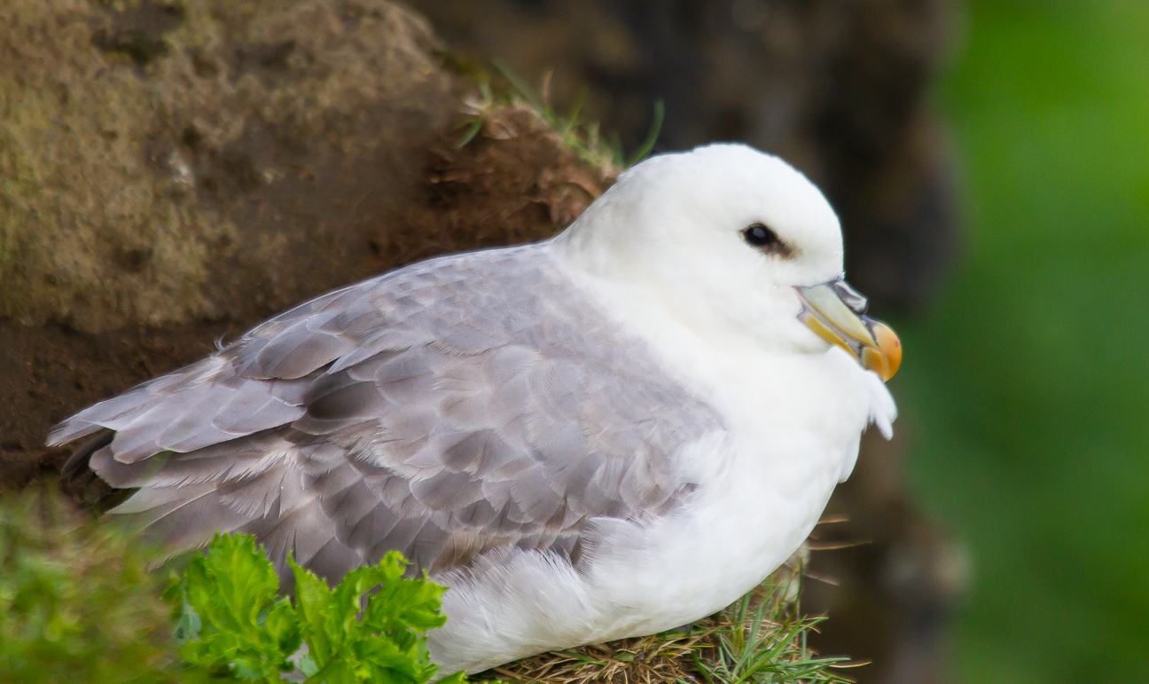
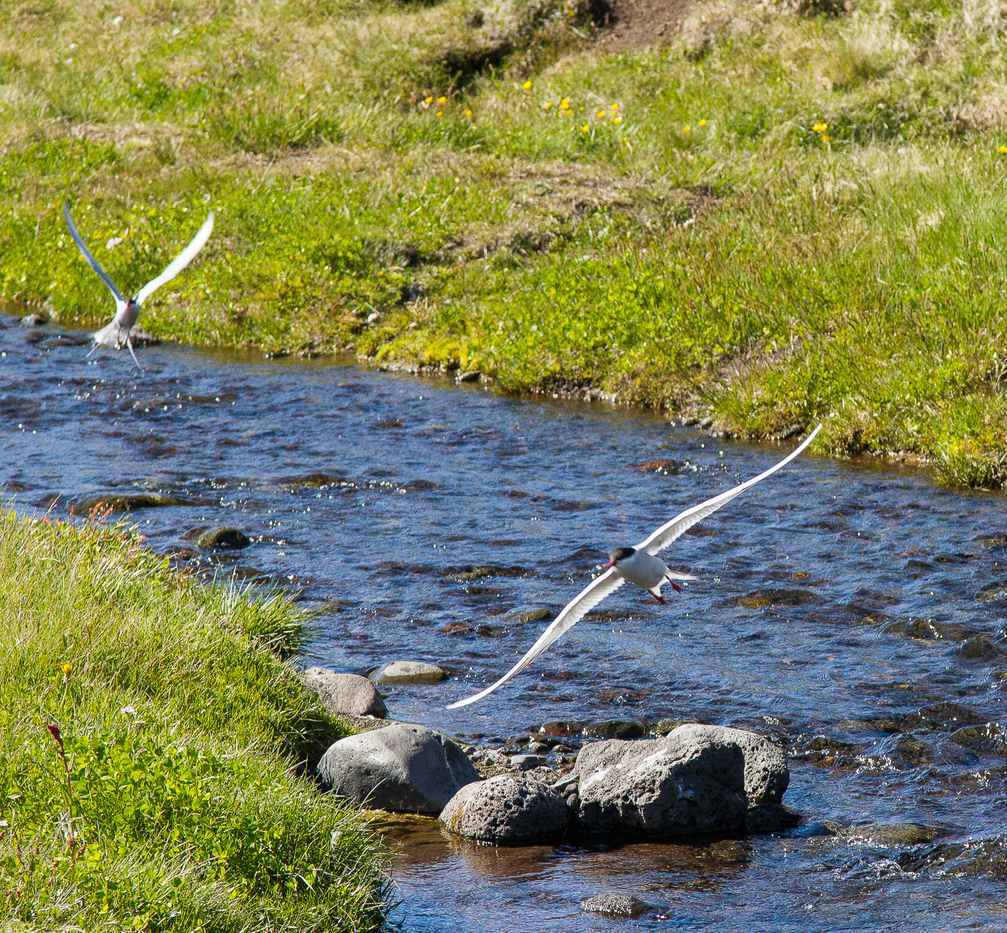
There is a final blog post to come with all the wildlife sightings in one place including dolphins, puffins and humpback whales.
After our four days at Bragdavellir Cottages it was time to move on to Vik on the south coast of the Island. We had an early start as we had a few stops planned on the way, the first being at Höfn, famous for its scenic views of Vatnajökull (the largest ice cap in Europe by volume). Unfortunately as you will see below clouds somewhat interfered with the view.


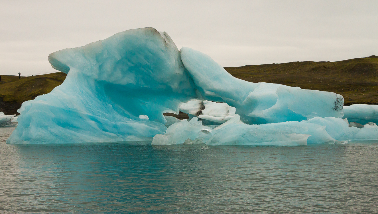
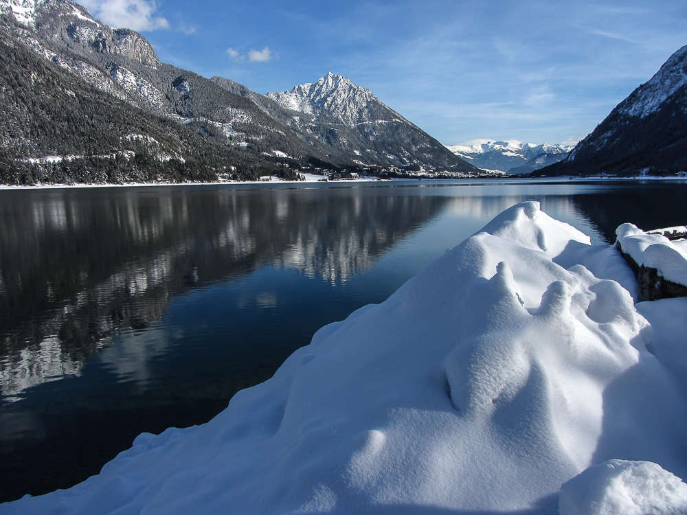
Our main stopping point on the way to Vik was Jökulsárlón or as it is more commonly called, and more easily pronounced, Glacier Lagoon. Situated at the head of the Breiðamerkurjökull glacier, it developed into a lake after the glacier started receding from the edge of the Atlantic Ocean. As you can see below its pretty spectacular and you can have a boat tour to get a closer look.


#


Next stop was a wander to the foot of the Skaftafellsjökull glacier in the Skaftafell National Park.


 And finally on to Vik to pick up some supplies before heading on another 10k to our cabin, making a journey of over 360k for the day. We stayed at Mid Hvoll Cottages


We stayed here for three nights and had some fine walks around the area.


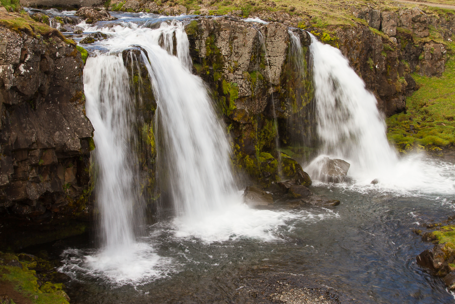
After our three days in Vik we were off to the bright lights of Iceland’s capital city Reykavik but not before two more stops on the south of the island. Firstly the spectacular Skógafoss waterfall.The Skógafoss is one of the biggest waterfalls in Iceland with a width of 25 metres (82 feet) and a drop of 60 m (200 ft).


You can walk up to the top of the waterfall and carry on for many miles into the island. The scenery looked spectacular and we would have loved to have had the time to hike further than the couple of miles that we did.


We then moved on to a view of Eyjafjallajokull, the volcano that erupted in 2010 and caused havoc with planes across Europe being grounded for days. The farm in the picture below was covered in thick ash during the volcano and the people from the farm are featured in an excellent film about the eruption showing in the visitors centre.


After our visit to Detifoss we set off on our journey to Djúpivogur on the east coast. Most of the way was on Route 1. The weather was dull but mostly dry but cloud levels were low so views were not great. We stopped off at Egilsstaðir, the largest settlement in eastern Iceland with a population of just over 2,000, for lunch, food shopping and of course a visit to Vinbudin the state liquor store.
Shortly after leaving Egilsstaðir we left Route 1 for a shortcut on Route 939, a gravel road also called Oxi after the pass it goes over. If you think of Oxi as a gravel road in the mould of The Wrynose pass but about 18k long then you get some idea of what it’s like. Add in the complication of it being in the clouds with resurfacing work going on but with no contraflow and you will see that made it an interesting drive. However, glimpses between the clouds showed some fine potential views so we returned to drive over in good weather a few days later, see photos further down the blog.

Now you may have wondered why the title of the blog is ICELAND-LAND OF FIRE, ICE AND LUPINES, well the lupine part anyway. The reason is that Iceland is covered in them. Apparently they were introduced from Alaska to stabilise the soil.

Our accomodation was one of some fine cabins at Bragdavellir Farm about 10k past Djúpivogur. The best place we stayed. Well appointed cabin, excellent WiFi, pleasant, helpful owners and fine walks on the farm itself, what more could you want? Oh, and its own 30m high waterfall Snædalsfoss.We were staying for four nights, many people only stay a night and there were quite a few entries in the visitors book regretting not staying longer.


We had some fine walks on the farm from the cabin.


And a short phone video from the same spot. A superb spot for a wild camp, now where’s my tent?


We decide that we wanted to back over The Oxi Pass in good weather and fortunately a break in the weather allowed us to. The map below has the route. Our cabin is marked with a pin near the bottom of the map. We followed Route 1 north along the coast to Breiðdalsvík, a small fishing village. Then Route 1 goes inland, becomes a gravel road and gains height through some splendid scenery until it meets the Oxi pass road, Route 939. Enjoy the photos.


The nearest village to the cabin is Djúpivogur about 10k away. Djúpivogur has a pleasant harbour, with an excellent cafe with a museum attached. I can thoroughly recommend the cakes at the cafe and the only hotel has a restaurant where we had the “unofficial” Icelandic national dish…pizza! It seems to be on every restaurant’s menu, probably because it is relatively cheap.


We started off our journey from Grundarfjörður in sunshine but by the time we reached our overnight stop in Akureyri it was cloudy and it would stay cloudy for the next few days. We also had our first major experience of “gravel roads” with about a quarter of today’s drive spent on them. Knowing when a road is going to be a gravel road is not straight forward. Many maps do not differentiate. Parts of the same road can be gravel and parts tarmac. Roadside information boards with maps do not tell you and indeed may describe a gravel road as a main route! Having said that the gravel roads are mostly of good quality and more like flat, hard earth roads with not much gravel.


We were only staying for one night in Akureyri but with an early start we could knock off the 90k journey to Lake Myvatn by 9.30am. The plan was to spend most of the day there then go and check in at our cottage the other side of Husavik, returning to Lake Myvatn the following day.
Akureyri is where Einstök Beer is brewed. Unfortunately we could not find anywhere selling it! Better go to Booths in Windermere then.


 Our accommodation in Akureyri was not as good as advertised. The lesson to be learnt is don’t book an apartment that could be any one of a number of different properties in the same town. It’s too easy for the owners to upload many photos from the best apartments and just a couple of carefully selected shots from the not so good.At least the fast food outlet below had shut down.


On the way up to Husavik we passed a large greenhouse complex heated by geothermal energy.


Our accomodation was about 40km past Husavik in a remote area. This was our furthest north at just over 66 degrees and less than 40 miles from the arctic circle. At this time of year, late June, it never gets dark in Iceland. The sun does go down for a few hours but its still quite light.


Alcohol is only available to buy in bars, restaurants and from a retail point of view the state owned Vinbudin chain of liquor stores. Prices in the stores are about twice the UK rate for wine and beer is about the same as specialist beers in an off-licence here. In a restaurant wine is very expensive and beer £5-£6 for 500ml. More about beer when we get to Reykjavik.
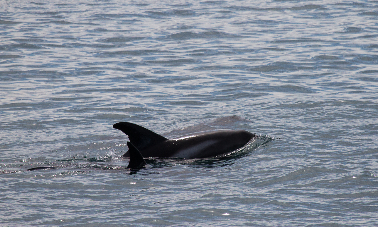
Husavik is the main centre for whale watching trips. They have a 98% success rate. Guess what? Yes, we were one of the 2%. Three hours and we saw no whales but we did see some dolphins. If you don’t see any whales you get to go again for free. Unfortunately the day we had left the weather was very poor so we did not go.


Instead of going whale watching on our last day near Husavik we went to Asbrygi in the Jökulsárgljúfur National Park


So our time in the north had come to an end. But we had one more attraction to visit in the north on our way to the east coast which would turn out to be our favourite part of the island.
So we set off down 862, the worst of the gravel roads we were to encounter, to Dettifoss and Selfoss waterfalls.
Dettifoss is 100m wide and has a drop of 45m and is claimed to have the largest volume of water flowing over it of any waterfall in Europe.
About a kilometer upstream from Dettifoss is Selfoss another spectacular waterfall.


Video of Dettifoss
For our trip to Iceland we decided that we wanted to tour round the outside of the island, based on Route 1 but to stay several days in each place so we could explore properly. It was always going to be a combination of normal tourist activities as well as hiking but my continuing problems with my heel meant that it would be more of the former and less of the latter.

We flew with Easyjet from Manchester on a Thursday and flew back on a Tuesday nearly three weeks later.We arrived at Keflavik Airport, about 30 miles south of the capital Reykjavik, at about 8.30 in the morning and by 9.30 we had picked up our hire car and were on our way to Grundarfjörður on the Snæfellsnes Peninsula on the west side of the island. We decided, as we had plenty of time, to detour off Route 1 on to Route 47 which takes you round the magnificent Hvalfjörður Fjord and with views like the ones below we were glad we did.


Route 47 after going all the way round the fiord delivered us back to Route 1 and we then had the short drive to Borgarnes for a lunch stop, to buy supplies and of course a visit to Vinbudin, the state operated liquor store. More about that in the next blog.
We also spent an enjoyable hour visiting The Borgarnes Settlement Centre which traces the early history of Iceland from AD 870 when the first Viking settlers arrived.
Just after leaving Borgarnes we left Route 1 for Route 54 towards the Snæfellsnes Peninsula. After about 35 miles we came to the junction with Route 56 which we were to take. There was a dubious looking cafe and petrol station, see photo below, but as we both needed the toilet we thought we would give it a go. Lesson One in Iceland, never judge a facility by its appearance outside. Inside was a very pleasant cafe with excellent staff. The staff, who were all young spoke perfect “American”, sometimes to each other. Most older Icelandic people speak good English but with an Icelandic accent.


We then just had a short journey to our first overnight stop at the delightful small town of Grundarfjörður. We were staying at the Grundarfjordur Guesthouse and Apartments. We had a room with a communal kitchen and sitting area. Again the building did not look up to much, in fact it looked like a warehouse, see photo below, but was very pleasant inside.
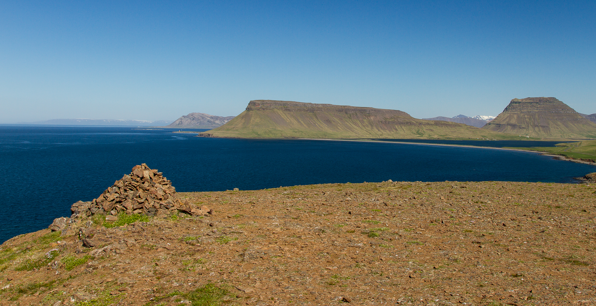
The town itself is very pretty and surrounded by magnificent scenery including the iconic Kirkjufell Mountain allegedly the most photographed mountain in Iceland.


The next day was probably the sunniest of the holiday. Typically daytime temperatures were between 12 and 18 degrees.We set off to go round the Snæfellsnes Peninsula coast taking in the Snæfellsjökull National Park containing the mountain Snæfellsjökull which is a 700,000-year-old stratovolcano with a glacier covering its summit at a height of 1,446 m (4,744 ft). Its famous for featuring in the novel Journey to the Center of the Earth by Jules Verne, in which the protagonists find the entrance to a passage leading to the center of the earth on Snæfellsjökull.
We passed through the viallges of Olafsvik, Rif, Hellinsandur, Hellnar and Arnarstapi.


The next day we headed further east to Stykkishólmur, where the ferry to the Westfiords sets off, and then worked our way back to Grundarfjörður with a few interesting stops including Helgafell (Holly Mountain) which it was once decreed that no one should urinate within sight of it!


Unfortunately my efforts to shake off my heel injury have failed and so reluctantly I have had to withdraw from this year’s TGO Challenge. A five mile walk yesterday, Saturday 25th April, ended with my heel being quite sore and it still was this morning. With only twelve days to go there is no way I am going to be able to walk every day for two weeks to get from one side of Scotland to the other.
Last December during a walk I developed a painful heel and the following day I could not put any weight on it. Six weeks of rest did not cure it. My GP then gave me a cortisone injection which resolved the problem. This allowed me to start walking again on my holiday in Austria. On my return in February I was able to build up the mileage and my strength. The heel was fine.
Training continued well and in the middle of March I had a two day backpack. At the beginning of April I started to get some discomfort on the side of my heel, a good couple of inches from the area of pain in December.A short family walk on 5th April ended with the heel being very sore and me knowing I had to do something to get this sorted if I was to make the TGO Challenge.
So at great expense to the management I made an appointment to see at The Body Rehab in Staveley. After much prodding and poking Sue’s verdict was that I had stiff tendons on both sides of my leg and lack of motion in my heel joints and toes. Three courses of painful treatment from Sue followed. The last one was last Thursday, 23rd April, and judging by how much less the pain was things were getting better. However as yesterday’s walk showed I still need more time and so I am withdrawing from this years event.
The plan now is to have at least a couple of weeks off walking, try some swimming and cycling, carry on with my exercises and hopefully recover so I can get out on the fells again. Thanks for all the get better wishes I have received they were much appreciated.
Now when are the entries out for the TGOC 2016?
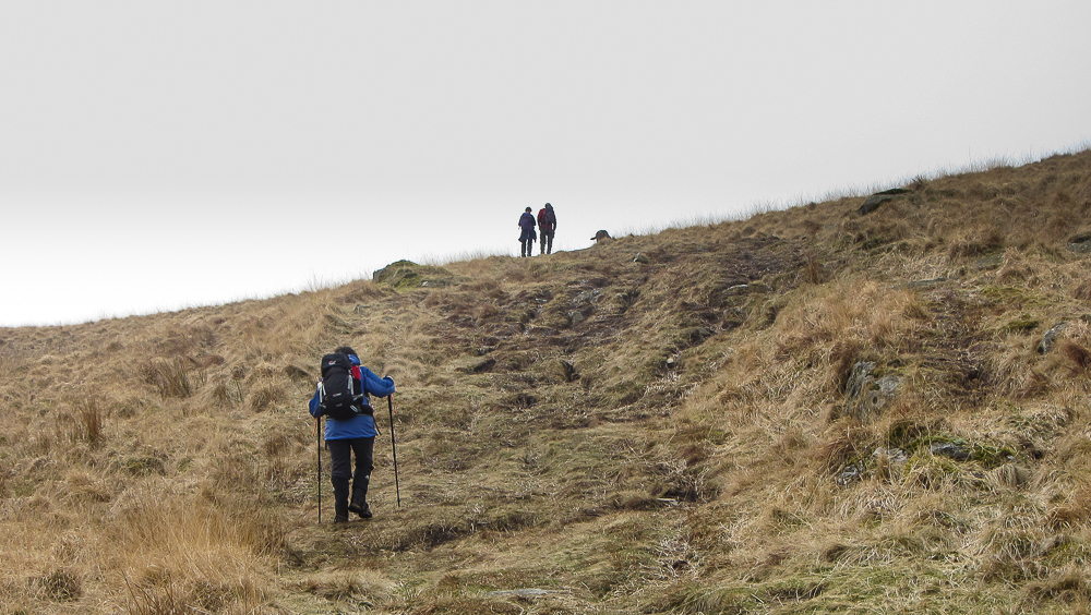
One of the advantages of living where I do, on the fringes of the Lake District National Park, is the ability to go backpacking from the front door. Last year I did two trips, one camping on Caudale Moor, day one here, and day two here, and the other camping on Thornthwaite Crag which can be found here.
Another advantage is that if your other half, Sian my wife in my case, wants to come for a walk, they can accompany you part way and then return home to a comfortable bed. So that’s how on Tuesday 17th of March Sian and I set off from home.
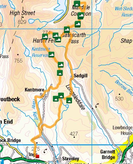
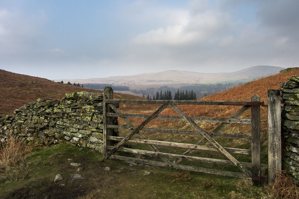
A bit of road walking took us down Browfoot Lane, a favorite way for mountain bikes to get to the bridleways of Kentmere Park, then a pleasant off road section brought us to Ulthwaite Bridge just off the Staveley to Kentmere road. A few hundred meters along this road took us to a bridle path to climb up towards the Green Quarter Fells.

The three Green Quarter fells are a tight group marking the high point between the Kentmere and Longsleddale valleys. They are a mixture of Wainwright’s Outlying Fells and Birkett’s . Having “bagged” these three it was time for Sian to head home and me to drop down to Sadgill in Longsleddale.


Many of you will know Sadgill as it’s where the road in Longsleddale ends and there are a few unofficial car parking spaces making an ideal start for walking the Wainwrights of Grey Crag and Tarn Crag. I had planned to have a break by the bridge, a spot of lunch and to top up my water supplies from the river. As I got there a lady vacated the bench. It was 12.15 and I was to see no one else, save a distant glimpse of a couple of fell runners, until 9.45am the following day. Who says you can’t get peace and solitude in the Lake District.


After a bite to eat I set off up Longsleddale. The road becomes a track going north from Sadgill. I continued for about another 3k, steadily gaining height until I reached the delightfully named Brownhowe Bottom at which point a bridle path heads off in an easterly direction to Mosedale and eventually Wet Sleddale. I took this path and decided it was time for lunch mark 2.


So far all the climbing had been fairly gentle. This was about to change as I started the steep grassy climb to gain Selside Brow and then continued on and up towards Branstree. The plan was to camp somewhere between Branstree and Selside Pike, possibly by the old observation pillar on Pillar. The problem was that there had clearly been a lot of snow up here, some of which remained, but what had melted had turned the area to bog.
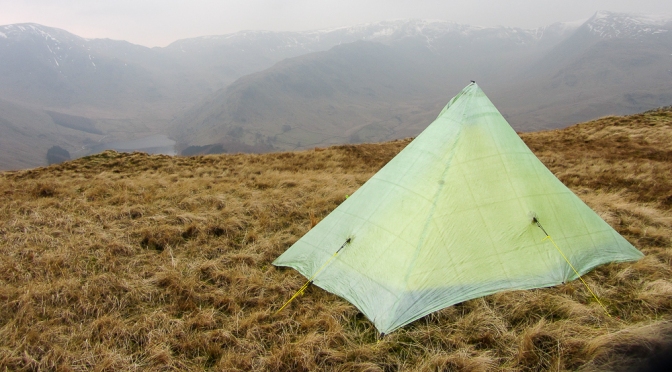
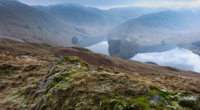
I took quite a few detours to possible camp spots on the walk from Branstree to Selside Pike via Pillar but found nowhere I was happy with. On Selside Pike I considered my options. There was a relatively dry flat pitch by the summit but I had not yet picked up any water. I could have melted some snow but as it was only 3.30 I decided to drop down towards the Old Corpse Road which has a beck running beside it. I took my pack in case I could find a better pitch. Once I was below the snow line the ground become very dry. I made good progress down to the beck. I then decided to look for a pitch on the other side of the Corpse Road on Brown Howe. This turned out to be an excellent idea as I soon found a good spot with views over Hawswater down to The Rigg. It was now 4pm, time to set up camp with about two and a half hours daylight left.


Now I have to confess I’m not a winter camper. Not so much because of the cold but the long dark nights. Spending long hours in the tent is not my idea of fun. Having said that I’ve now got a kindle paperwhite and combined with music from my phone time soon passes. This was to be the night of the aurora. Despite the fact that most of the sky became clear the northern horizon remained hazy, so no aurora for me.
I got up for a call of nature about 4pm, the sky was clear, except to the north, and the temperature had dropped well below freezing. My trail shoes were frozen!
I got up about 6.30 and the tent was frozen solid with lumps of condensation ice. The clear skies had now been replaced with haze and the tops of Branstree and Harter Fell were in cloud.


By 8.00am I was on my way again.The plan was to retrace my route from yesterday as far as Branstree then to climb Harter Fell and take the ridge down to Kentmere and the a low level route back home.


From Branstree I dropped down to Gatesgarth Pass, picked up some water, and had a break. Just as I was packing up a noise startled me as another walker came up the path. The first person I’d seen in over 21 hours. I climbed up Harter Fell, with a short detour to take in Adams Seat. There were some quite significant snow banks still here. The sun was threatening to burn off the clouds giving a strange light. It finally succeeded between Harter Fell and Kentmere Pike.


Now if you are doing the Kentmere Round most people head straight from Kentmere Pike to Shipman Knotts missing out the small detour to Goat Scar a “Birkett”. Its worth taking the detour then just by Goat Scar is a stile, cross this and head to an obvious cairn less than 50m away. This is a fabulous viewpoint for Longsleddale.


From here it was over Shipman Knotts, through the delightful village of Kentmere, back along the Kentmere Valley to Browfoot and home.


Day 1 was 14.4 miles with 3600ft of ascent and 2500ft of descent.
Day 2 was 13.5 miles with 2500ft of ascent and 3600ft of decent.
Total 27.9 miles with 6100ft of climbing. A good bit of training for the TGO challenge which I start on May 8th. All the kit I took worked fine and I was particularly pleased with my trail shoes this being my first backpack wearing them.
One of the first things I decided when I started this blog was that I would not attempt to post every day walk I did. Being retired and living in Cumbria there are just too many of them. A day walk in The Lakes need to have that something extra to justify a post. So what was special about this walk? It certainly was not the wall to wall sunshine that was forecast but failed to materialise, and certainly not the high winds that were forecast that did materialise adding an icy backdrop to proceedings. However having snow covered fells contrasting with the green valleys and dark menacing clouds above the tops punctuated with the occasional patch of blue sky letting in rays of sunshine to illuminate part of the landscape combined with it being a favorite walk was special.
So why is this a “Favorite walk”? Well look what you get for only nine and a half miles walking with 2,600ft of ascent. Six “Wainwrights”, The Knott, Rampsgill Head, Kidsty Pike, High Street, Thornthwaite Crag and Gray Grag. Views of two lakes, Ullswater and Windermere, one reservoir, Hawswater, one recently decommissioned reservoir, Hayswater plus Brothers Water. Views of The Pennines and Howgills to the east and the Helvellyn range to the west and valleys ranging from Kentmere to Patterdale. And then there’s the wildlife, red deer and even the possibility of seeing England’s only golden eagle. If you fancy a bit of a longer outing you can, as we sometimes do, add on High and Low Raise or take a detour via Mardale Ill Bell.
The route is below, click on the map to be taken to the social hiking page. The start is at the small car park at the end of the road that goes through Hartsop, only twenty minutes from our house, another reason its a favorite walk. 🙂

From the car park the route is fairly straight forward following the path up alongside Hayswater Gill. Hayswater used to be a reservoir. It had been unused for many years and so in 2014 United Utilities decided to return it to its former existence, rather than pay for maintenance, as a tarn and removed the dam. In doing so they moved the bridge a couple of hundred yards down steam so that it now crosses the gill where the right of way does.
The path then climbs steeply up grassy slopes until you reach the path from Boredale Hause that winds its way up to High Street. In spring and summer you are guaranteed to spot some Coast to Coasters on the Patterdale to Shap leg. Look out for the Harvey C2C maps! Following this path, you soon come to the point were a small detour takes you up to The Knott. An excellent spot with particularly good views to the Helvellyn range and also down passed The Nab to Hallin Fell and Ullswater beyond.


We didn’t hang around too long on The Knott as the wind was quite fierce. Its only a short stroll up to Rampsgill Head, according to Social Hiking there were sixteen minutes from us arriving at The Knott, taking the above photos and getting to Rampsgill Head. The “Wainwrights” come thick and fast now.
A few yards north of the summit of Rampsgill Head, the ground drops away and usually this is a nice sheltered spot to have a coffee break, get out the binoculars and spot the red deer down below in the valley. Sightings are pretty much guaranteed. In autumn during the rut, the haunting calls of the male deer can easily be heard from hear. Unfortunately because of the wind direction it was not in the slightest bit sheltered so off we went to Kidsty Pike, coincidentally also taking sixteen minutes.
Kidsty Pike is the highest point on Wainwrights Coast to Coast path…except for those “coasters” who missed the turn and end up on High Street by mistake, and we have met a few! It stands above the valley of Riggindale where red deer also roam. However Riggindale is also the home to England’s only resident golden eagle.Twice whilst walking this route we have seen him. Once from Kidsty Pike, he was well below us and we saw him swoop down and land on a rock. He was in amongst some red deer which gave a good indication of his size.


The going was not so easy from here up on to High Street, with some deep snow and some ice. On a nice day a good lunch spot is Short Stile, a small prominence above Riggindale off the path up to High Street, you can’t miss it in good visibility it has a cairn. This is where a few years ago we had our best view of the golden eagle. We were taking our eldest son Adrian, round this route and stopped on Short Stile for a bite to eat. We noticed the eagle below us, circling and gradually gaining height. As he did so he also gradually moved down Riggindale towards Hawswater. We must have followed him for a good five minutes. On both occasions we have spotted the golden eagle he has been below us. So that’s our tip for spotting him, look down and not just up.


Now at 2,717ft High Street is the highest point on the route, but apart from the trig point there is not a lot to see, as the top is a bit of a plateau. Today it was also very windy and icy as the wind had scoured the terrain. So we set off for Thornthwaite Crag, soon picking up fine views again. Froswick, Ill Bell and Yoke with Windermere in the distance and in the other direction Hayswater surrounded by fells.


Thornthwaite Fell is one of those classic Lakeland locations, like Esk Hause or Helvellyn summit shelter, where you can always find someone taking a well earned break. So this was to be our lunch spot today. We could not shelter directly behind the wall as normal as great mounds of snow had beaten us to it :-(.


Now probably the most popular way back to Hartsop from here is via Threshwaite Cove, however I think descending via Gray Grag is far superior. There are excellent views all the way along the ridge especially west over Hartsop Dodd and on towards Helvellyn, later there are fine aerial views of Hartsop itself and Brothers Water and a small detour east and you have good views down to Hayswater.


Once the steep nose of Gray Crag has been negotiated, a bit tricky with snow today, there is just a short walk back to the car with a quick glance over “Pasture Bottom” up to Threshwaite Cove.

After our fine week in Leutasch we moved onto Pertisau on the banks of Achensee Lake further east across the Karwendel Alps. A quick taxi ride to Seefeld, twenty minute train ride to Innsbruck, change trains, another twenty minute train ride this time to Jenbach and another short taxi ride and we were there. There is a good webcam here if you want to take a look.


We were staying at the excellent Appartementhaus Tristenau and were greeted on arrival by Maria who to our relief spoke excellent English (Note to self…must learn some German before next trip!).


A quick inspection showed that our apartment had everything we could want, including a fine view and free WiFi.You can see what type of apartment we had here. By 1.30 we were settled in so we set off to explore our surroundings, get our bearings and stock up on some provisions.


The following day we set off for Gernalm, a superb Alpine Inn, serving delicious large bowls of soup. In fact it was so good we did an extended walk there later in the week. The two walks can be found on Social Hiking here and here.


On Monday the forecast was for low cloud all day. So we decided to go into Jenbach and get our train tickets for Saturday for our return to Munich Airport and also to reserve seats as the excellent Austrian Trains web site advised. We had used Google Translate to write out what we wanted just in case, but we need not have worried as the man in the ticket office spoke excellent English. Not sure how easily a German speaker would have got on at say Oxenholme Station!. We then took a trip on the Zillertalbahn Railway as far as Zell am Ziller to see what the winter walking was like for a potential future holiday. A quick chat in the tourist office and it was obvious that winter walking opportunities were limited so Zell am Ziller was crossed off the to do list. Still the train was good and in summer some of the time its operated by a steam locomotive.

We woke up on Tuesday to about nine inches of fresh snow and glorious sunshine. We set off to climb up to Feilalm, an alpine hut that overlooks Perisau. However at the bottom on the trail the sign that had said “geöffnet”, open, on Sunday (See I have picked up a little German 🙂 ) now said “geschlossen”, closed! We later learnt that this was due to avalanche risk, and unfortunately it remained closed all week.
So instead we took the trail up to Gramaialm, another superb alpine hut/hotel/restaurant. It has plenty of rooms plus some apartments, you can drive up in summer and it looks a grand staging post for higher level walks and it serves wonderful goulash soup. Enjoy the photos from the day and the route on Social Hiking can be found here


On the Wednesday we went to Achenkirck at the other end of Achensee using the free bus service. We decided to walk up to Christlumalm a ski hut/restaurant. The path is on a toboggan slope that crisscrosses the downhill ski slopes so it was “entertaining” at times and whilst the path had been groomed it had not been as well compacted as others we had used, this added to the fairly steep slope made it hard going. When we started off it was cloudy but by the time we reached the top the sun was out. The route on Social Hiking can be found here.


On our last day the weather was not too good and I had gone down with a cold so we just had a stroll around Pertisau and the lake.


Our favorite place to eat out in Pertisau was LANGLAUFSTÜBERL mainly because it has its own micro brewery brewing Achensee Beir. Its still a continental style larger but it had quite a bit more taste than most. The food was excellent with a good selection of Austrian specialties and free WiFi.
So our two weeks in Austria came to an end, and very enjoyable they were. We will definitely be back but probably in the summer next time.
Everything went to time coming home, Taxi to Jenbach, train to Munich airport with one change on the outskirts of Munich and flight with Lufthansa to Manchester.
The blog for all who want to learn German...
A tale of early retirement in the UK, motorhomes and life in general
travels in our WildAx campervan
Jack and Elaine's 2017/2018 tour from Spain, by road, down to Greece and then up to Poland before heading home
Travels around Europe & Beyond in a motorhome.
Always on the lookout for our next Adventure, either in our VW Campervan or worldwide
...and a few more reasons for climbing mountains
Wandering in the Cairngorms and other lesser ranges, by Neil Reid
Mountain and Wilderness walking, living the high life, wild camping, hiking in the Great Outdoor
Walking The Wainwrights and Wandering the Globe
You can walk anywhere, you just need enough time.
hiking, trekking, backpacking, wild camping, travel, outdoors
hiking, trekking, backpacking, wild camping, travel, outdoors
Fun not fear in the outdoors. "Succinct sensible advice, impossible to fault" - Chris Townsend "He's not wrong..." - TGOmagazine #askdale
Wanderings up North
Walking, camping, taking it easy
hiking, trekking, backpacking, wild camping, travel, outdoors
the musings and meanderings of a part-time backpacker and hiker.
An introverted geek that is just trying to get out more!
hiking, trekking, backpacking, wild camping, travel, outdoors
hiking, trekking, backpacking, wild camping, travel, outdoors
hiking, trekking, backpacking, wild camping, travel, outdoors
hiking, trekking, backpacking, wild camping, travel, outdoors